
Flowing through the
Dark Waters

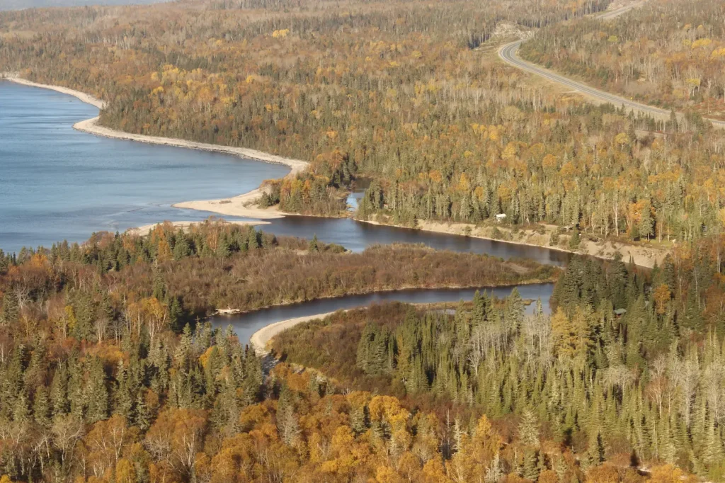
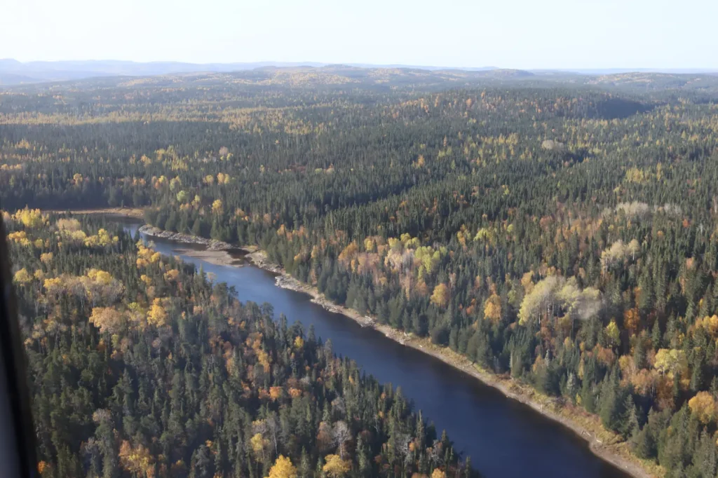
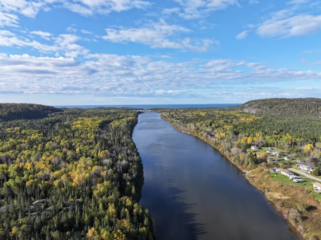
The Mkade Ziibii (Black River) begins at an unnamed lake northeast of Manitouwadge. It flows 160 kilometres south, joining the Biigtig Ziibii (Pic River) for the last three kilometres before spilling into Gichigami (Lake Superior). The dark waters of the Mkade Ziibii have supported our community for generations, offering a travel route, food, and place of connection.

All in a Name…

It is believed the Mkade Ziibii got its name from the dark colour of its water. It is also possible that the Ojibwe word for a dark or black liquid, makadewaagamin, informed the English name “Black River.”

Dam

New Community Cabin

New Community Cabins (x2)

New location of Jackfish Camp

Original Jackfish Camp

Bigrock Camp

Wabous Camp

Moses Camp

New Developed Campsite

New Developed Campsite

New Developed Campsite

New Developed Campsite

Future Camp Site

Camp 14 Campsite

Esker Lake Camp Site (Temp)

Mooz Zaaghigan/Moose Lake/Esker Lake

Steel River Camp

Gaa-wmbaawngaag Zaaghigan Gbeshwining/Sandy Hill Lake Campsite/Aster Lake Campsite

Steel Lake Camp (Temp II)

Steel Lake Camp (Temp)

Steel Lake Camp Site II

Gaa-wzhaawshkwaabkaag Zaaghigan Gbeshwining/Bluestone Lake Campsite

Steel Lake Camp Site I

Wkikaandag Gbeshwining/Jackpine Campsite/Steel Lake Camp

Diablo Camp

New Diablo Camp Site

Dik Gbeshwining/Caribou Campsite

New Mountain Lake Camp

Gaa-gidjiiwaabkaag Zaaghigan Jiimaan Gbeshwining/Mountain Lake Canoe Camp

McKay Lake Camp

McKay Lake Camp

Pukatawagan Sandbar Camp

Puktawagan Ginoodaawangaa Gbeshwining/Pukatawagan Sandbar Camp

Sandbar Camp I

Michal Bridge Camp

Michal Zaaghigan Aazhogan Gbeshwining/Michal Lake Bridge Campsite

High Falls Camp

Giiwedin Ishpigakaamikijiwan Gbeshwining/North High Falls Campsite

Jackfish Camp

Ginoozhe Zaaghigan Gbeshwining/Pike Lake Campsite

Waboosekon Camp

Waboosekon Gbeshwining/Waboosekon Campsite

Tickseed Camp

Tickseed Gbeshwining/Tickseed Campsite

Caramat Camp

Caramat Gbeshwining/Caramat Campsite

Canoe Camp Site

Mnidoo Gkaamkijwang Gbeshwining/Manitou Falls Campsite

Legend

Click map icons to reveal more information.

Ancient Connections

There have been many significant archaeological finds around the Mkade Ziibii, some of which date as far back as 8,000 years. However, much of its early history remains undocumented. Some of the history of this river remains a mystery.

Fun Fact

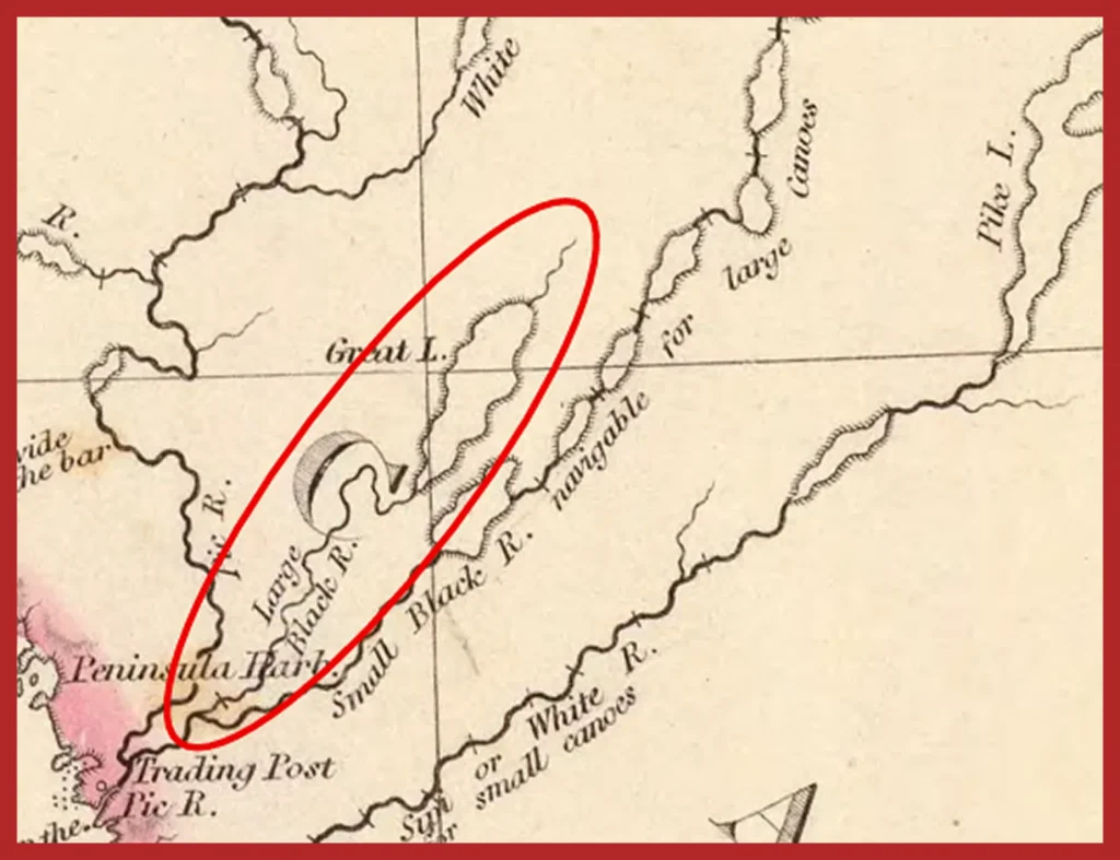
The earliest map with the Mkade Ziibii is from 1832. On this map, the river was labelled as the “Large Black River.” One of its tributaries was labelled as the “Small Black River” and was noted to be navigable by large canoes.

Logging Industry

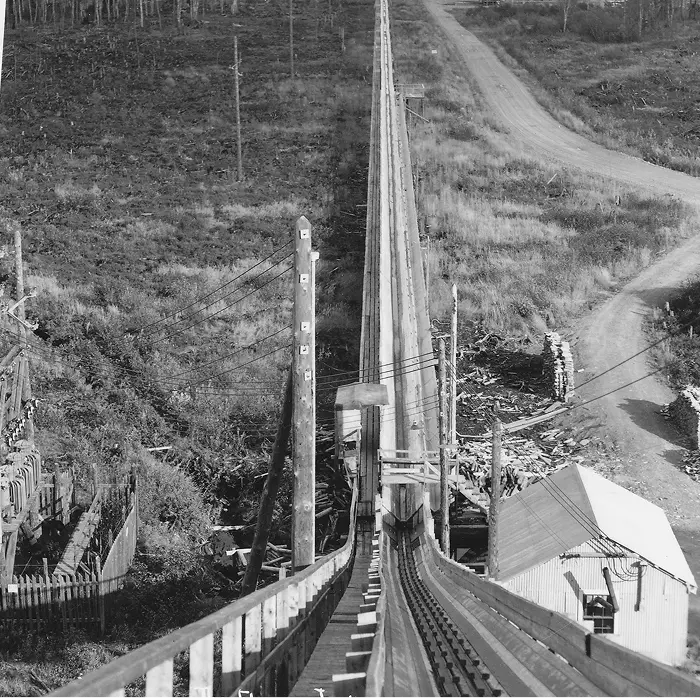
The Mkade Ziibii joins the Biigtig Ziibii about three kilometres from the mouth of the Biigtig Ziibii at Lake Superior, offering a perfect route for log drives. In the 1930s, logging companies competed for access to this river. To avoid this competition, the Ontario Paper Company used a flume to hold its wood at the mouth of the Mkade Ziibii before the meeting of the two rivers.

The flume (a human-made wooden channel that uses a non-stop flow of water) carried logs over land instead of on the Mkade Ziibii. The flume ended in Heron Bay, on the shores of Lake Superior. It was five -and-a-half kilometres long, with a bridge 91 metres long and 24 metres above the mighty Biigtig Ziibii (Pic River). The flume was featured in Ripley’s “Believe It or Not” for the bridge portion carrying water over water. It took about 45 minutes for logs to travel to the bay. The flume remained in place until 1965.

Meanwhile, on the river, the log drive continued until 1964. At this time, it became less expensive to ship the logs by rail: as logging had moved inland, further from shorelines and rivers. Our community can still picture the log drives, the dark figures bobbing along the inky waters of the Mkade Ziibii, so full of logs that you could cross the river on them.

Water Power

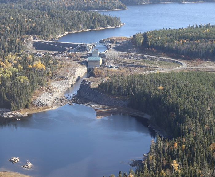
In 1987, Biigtigong Nishnaabeg led the development of the Wawatay Generating Station. The station is a small hydroelectric dam on the Mkade Ziibii. Over 60 members played a role in building the dam. This is one of several hydro dams that provide Biigtigong Nishnaabeg with reliable, renewable energy, helping our community to be independent without sacrificing the natural environment. The dams allow us to invest in our community, including through housing and education programs.

The Wawatay Generating Station was the first Canadian hydro project owned by a First Nation. Our community is proud of this project and its low impact on the environment. Biigtigong community members took extra measures to ensure that newly hatched fish species were protected. We created a special area away from the strong currents below the dam. This area protects young fish. It gives them time to grow before entering the strong currents of the main river.

Geology

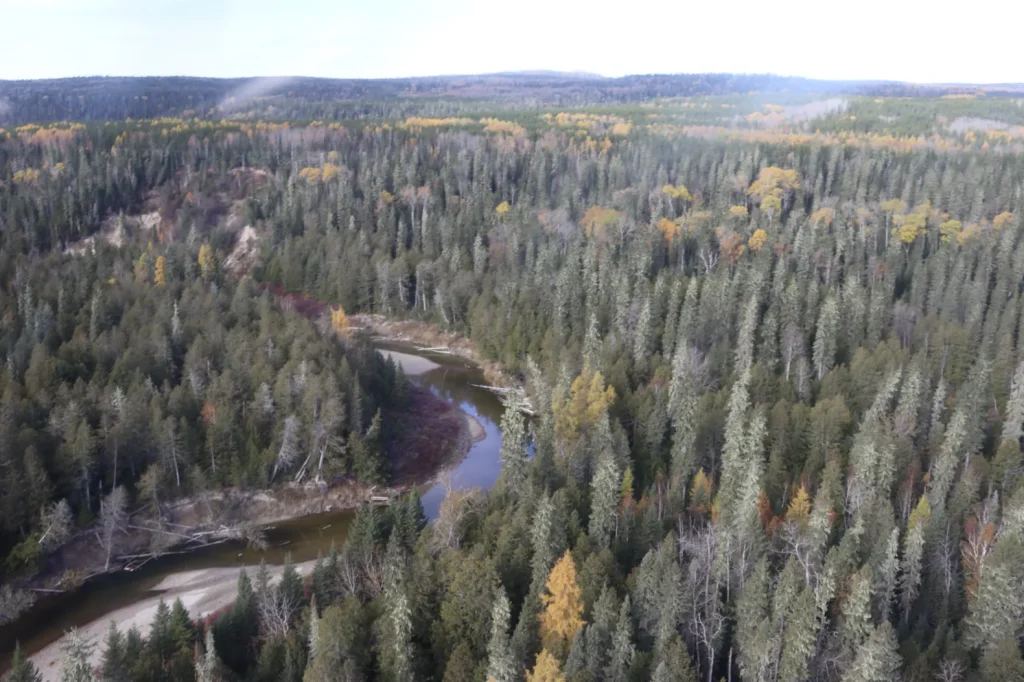
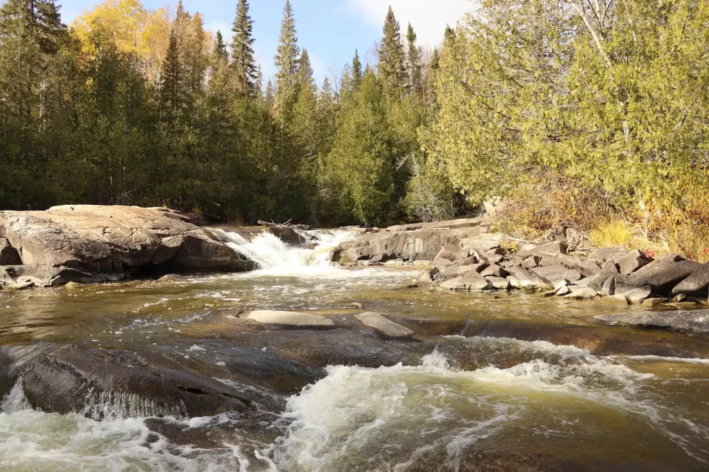
Mkade Ziibii’s path flows through the ancient rock of the Canadian Shield. Its shores support boreal forest species such as pines and cedar. The riverbanks are steep and the dark waters ripple through the path the river has carved. The mouth of Mkade Ziibii opens to the Biigtig Ziibii (Pic River) which drains into Lake Superior, flowing through dramatic sand dunes, sharp rock faces, spruce forests, and muskeg.
Canoe Routes

Biigtigong members and visitors use ancient portage trails and modern access points to experience the solitude of these lands and waters and uncover the secrets of the past.

Research On The River

In order to project our river, we are studying it. By speaking with people who use the land, and with Knowledge Holders, we have documented travel routes, cultural sites, and harvesting locations for plant and other resources, big and small game, birds, and fish species connected to Mkade Ziibii.

Biology

Mkade Ziibii is home to many species that are culturally significant to us. Our people fish, hunt, trap, and gather along the river. Some of the species that can be found here include trout, perch, white suckers, river otters, and eagles.

References

Boultbee, J. (1967). Pic, Pulp and People- A history of the Marathon District. Marathon, ON: The Marathon Area Centennial Committee.

Buchan, J. D. (1972). Logging of the Black and White Watersheds: The pre-mechanization era 1890-1950. Retrieved from https://nfmcforestry.ca/wp-content/uploads/2024/09/History_White-River-Division-Watershed.pdf

Krackle, J. (2015). Biigtigong Nishnaabeg has long history of developing hydro dams. Retrieved from https://anishinabeknews.ca/2015/12/biigtigong-nishnaabeg-has-long-history-of-developing-hydro-dams/

Nature Metrics. (2024). Environmental DNA Report: Freshwater fish (excl. sharks & rays). Nature Metrics.

Norris, D. (2025). Summary Archaeological Background – IPCAs Waterways. Thunderbay, ON: Woodland Heritage Northwest.

Ross, I. (2009). Pic River First Nation adds power to their energy mix. Retrieved from Northern Ontario Business: https://www.northernontariobusiness.com/industry-news/green/pic-river-first-nation-adds-power-to-their-energy-mix-366031

Various Biigtigong Nishnaabeg Members. (2024). Land Claim Project. Shared Value Solutions Ltd. Retrieved 2025